Buckhead bags $10M in federal funding for elevated bridge project Josh Green Thu, 09/05/2024 - 13:33 An important component of a sweeping plan to make the heart of Buckhead’s commercial and shopping district more walkable and bikeable has scored a federal cash boost.
According to Buckhead Community Improvement District officials, the U.S. Department of Transportation’s Safe Streets and Roads for All grant program has awarded $10 million to help construct an elevated pedestrian and bicycle bridge in the district.
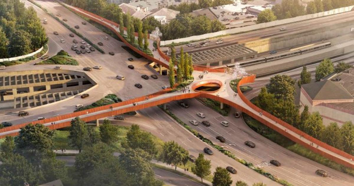
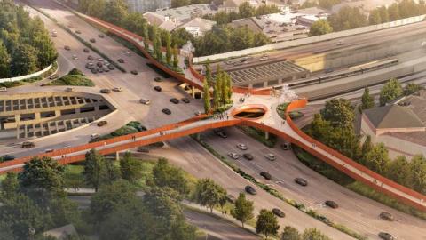
Plans call for the swooping bridge project to span Lenox Road’s intersection with Ga. Highway 400, where the Buckhead Loop roadway is 10 lanes wide at one point. The design in such a highly trafficked vehicle corridor will enhance safety and mobility in the area while providing a direct link to the district’s future highway-capping park, officials have said.
Buckhead’s growing PATH400 greenway runs near the intersection, and plans call for the bridge to also link directly to that project.
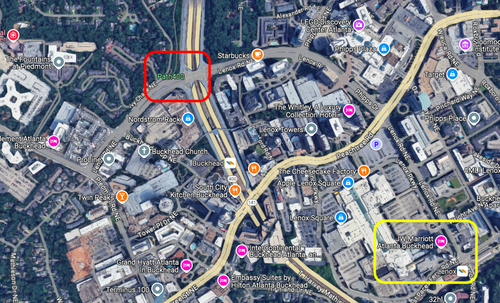 Location of the Buckhead Loop bridge project (top, in red) in relation to Lenox Square and its neighboring MARTA station (bottom, in yellow). Google Maps
The bridge is considered the third phase of the Lenox Road Complete Safe Street project. That’s aiming to remake 1.25 miles of the major corridor into a people-friendly route for pedestrians, bicyclists, and other non-motorists that stretches from the Lenox MARTA station to Piedmont Road.
Another key section of the Complete Street project is scheduled to begin construction in a matter of days, as BCID reps tell Urbanize Atlanta.
Total costs for the bridge and related work are estimated at $40 million. Designs call for it to rise on the south side of Lenox Road with ramps that allow users to cross both Ga. Highway 400 and Lenox Road without mixing with car traffic.
BCID is partnering with both the Georgia Department of Transportation and City of Atlanta to construct the bridge, which will span a total of .62 miles.
 Plans for the Lenox Road Complete Safe Street project’s third phase. Courtesy of Buckhead CID
 The Buckhead Loop intersection in question today. Google Maps
Jim Durrett, BCID executive director and Buckhead Coalition president, said in today’s announcement the $10 million in federal funding is “essential to help us transform this section of Lenox Road and provide safe, easy access for pedestrians and cyclists to reach the Buckhead and Lenox MARTA stations and many other locations” in the district’s core.
Added BCID chairman Thad Ellis: “Making a major highway intersection safe and accessible for pedestrians and cyclists is no small task.”
When the bridge was initially announced two years ago, plans called for construction to begin in late 2024, but the timeline has been bumped back.
According to BCID officials, engineering design for the bridge is on pace to be finished next August. Following a public bidding project, construction is now estimated to begin in October 2025.
BCID and GDOT’s goal is to complete the bridge by January 2028.
Other federal funding secured through the Atlanta Regional Commission is in place to go toward the “gracefully curving, elevated bridge” project’s construction, BCID officials have previously said.
Meanwhile, on the opposite end of Lenox Road’s three-phase Complete Street, construction on the Lenox Boardwalk portion next to Lenox Square mall was expected to start in late 2023 and again in April but was delayed.
But fear not, according to BCID officials: Construction on the Lenox Boardwalk section next to Lenox Square mall is all set to officially kick off Sept. 16.
…
Follow us on social media:
Twitter / Facebook/and now: Instagram
• Buckhead news, discussion (Urbanize Atlanta)
Tags
Lenox Road at Ga. Highway 400 Elevated Buckhead Bridge Lenox Road Complete Street Project Lenox Square Buckhead Loop PATH400 HUB404 Buckhead CID Buckhead Community Improvement District Alternate Transportation Bike Lanes Atlanta Bike Infrastructure Atlanta Regional Commission Georgia Department of Transportation Lenox Boardwalk U.S. Department of Transportation Safe Streets and Roads for All Lenox MARTA station Jim Durrett Complete Streets
Images
Location of the Buckhead Loop bridge project (top, in red) in relation to Lenox Square and its neighboring MARTA station (bottom, in yellow). Google Maps
The Buckhead Loop intersection in question today. Google Maps
Plans for the Lenox Road Complete Safe Street project’s third phase. Courtesy of Buckhead CID
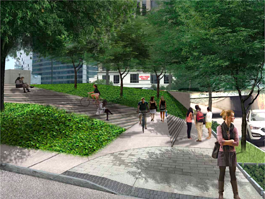 Pedestrian infrastructure improvements planned for section two of the Lenox Road Complete Street vision. Courtesy of Buckhead CID
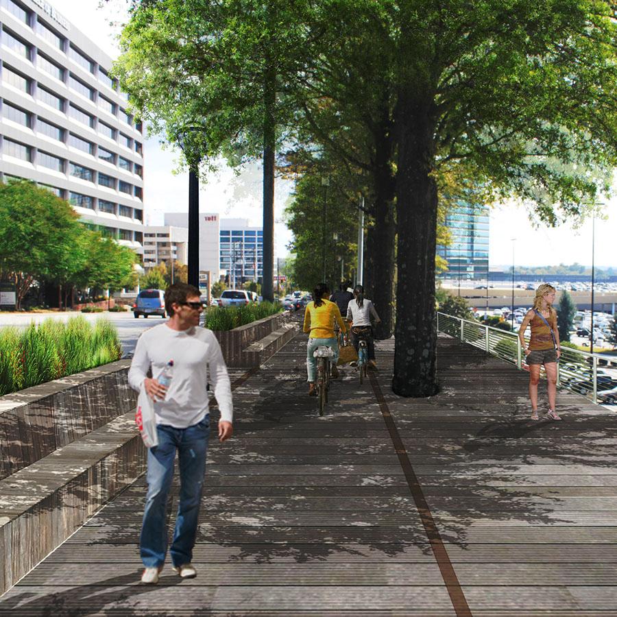 Conceptual plans for the Lenox Boardwalk’s initial phase. Courtesy of Buckhead CID
Subtitle USDOT’s Safe Streets and Roads for All grant boosts prospects for Complete Street component
Neighborhood Buckhead
Background Image
Image
Before/After Images
Sponsored Post Off